Microsoft Office Windows 11 Visual Studio Adobe Photoshop Adobe Illustrator Adobe Premiere Pro Software Solutions Adobe Photoshop Adobe Illustrator Microsoft 365 Autodesk

Civil 3D

Add your review

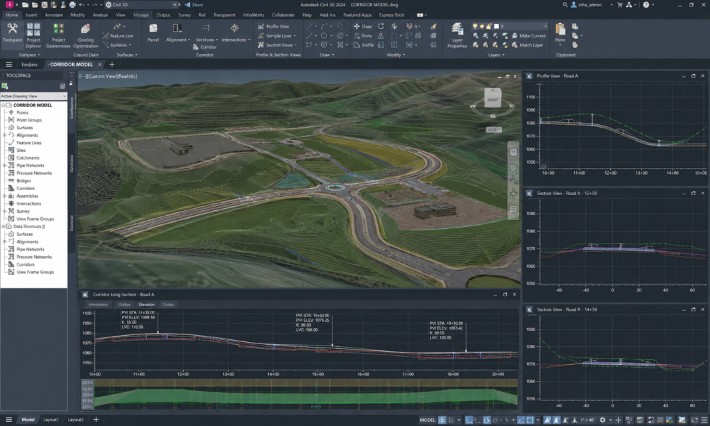
Autodesk Civil 3D is professional civil engineering and infrastructure design software used by civil engineers, surveyors, designers, and construction teams to plan, model, analyze, and document roads, highways, grading, land development, drainage, pipe networks, and survey projects with powerful 3D design and documentation tools.

×

Talk to a Licensing Expert

Get personalized guidance to find the perfect software license for your business.

    Buy the best software for your business

    Trusted by 21000+ Happy & Satisfied Business.

    1000+

    Software

    Free

    Consultation

    Best Price

    Guaranteed

    Talk to a Licensing Expert

    Get personalized guidance to find the perfect software license for your business.

      Get Free Demo
      ×

      Talk to a Licensing Expert

      Get personalized guidance to find the perfect software license for your business.

        Buy the best software for your business

        Trusted by 21000+ Happy & Satisfied Business.

        1000+

        Software

        Free

        Consultation

        Best Price

        Guaranteed

        Talk to a Licensing Expert

        Get personalized guidance to find the perfect software license for your business.

          Get Free Consultation
          9.5/10 (Expert Score)
          Product is rated as #7 in category Autodesk

          Autodesk Civil 3D

          Professional Civil Engineering, Road Design & Infrastructure Software

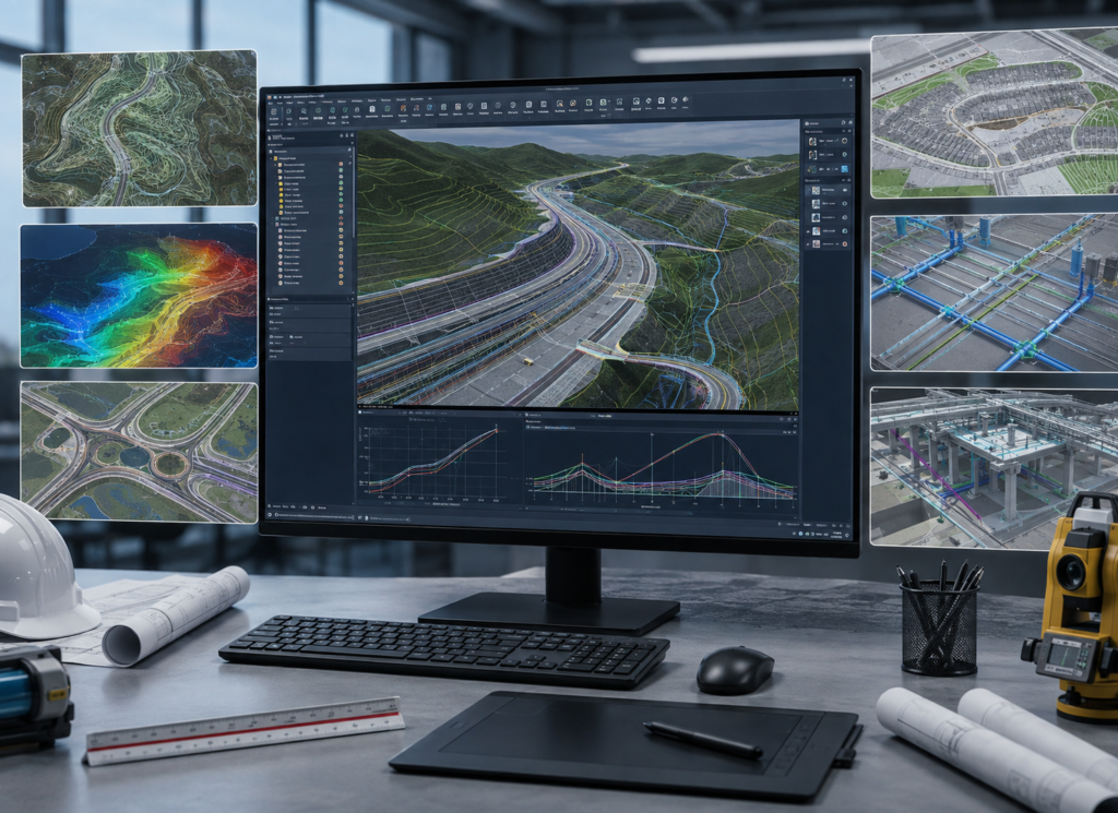
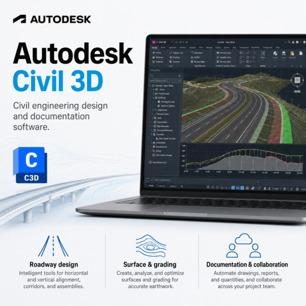
          Design, model, analyze, and document civil infrastructure projects with Autodesk Civil 3D, a professional civil engineering software for civil engineers, surveyors, designers, and infrastructure teams. Create road and highway alignments, profiles, corridors, terrain surfaces, grading plans, pipe networks, drainage systems, survey data, and construction documentation in one connected environment. Autodesk Civil 3D helps improve design accuracy, automate engineering workflows, reduce project errors, and streamline road, land development, transportation, drainage, and infrastructure projects.

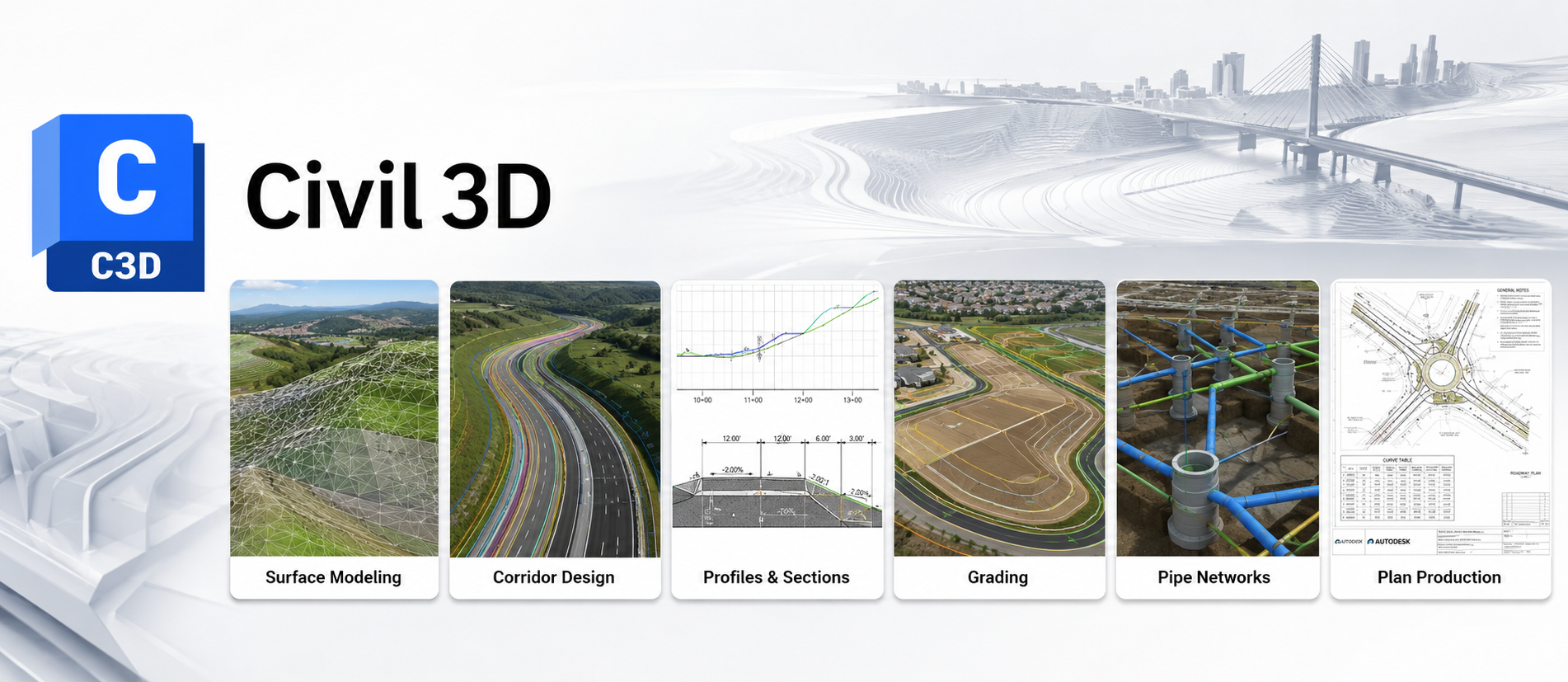
          Surface Modeling: Create accurate existing and proposed ground surfaces with Autodesk Civil 3D. Generate contours, elevations, slope analysis, and terrain models to support road, land development, grading, and infrastructure design projects.

          Road & Highway Design: Design roads, highways, alignments, profiles, and cross-sections with professional civil engineering tools. Civil 3D helps engineers create accurate transportation layouts and manage design changes efficiently.

          Corridor Modeling: Build dynamic 3D corridor models for roads, highways, railways, and transportation projects. Update corridor geometry automatically when alignments, profiles, or assemblies are modified.

          Grading Design: Create grading plans for sites, building pads, slopes, parking areas, and land development projects. Calculate cut and fill requirements and manage earthwork more accurately.

          Pipe Network Design: Design stormwater, sanitary, drainage, and utility networks using pipes, structures, and connected infrastructure components. Create detailed plan and profile documentation for construction.

          Survey & Point Management: Import, organize, and manage survey points, field measurements, and existing-condition data. Use survey information to build accurate terrain models and engineering drawings.

          Quantity & Earthwork Analysis: Calculate cut and fill volumes, material quantities, and earthwork requirements directly from Civil 3D models to support estimation, planning, and construction workflows.

          Plan Production & Documentation: Generate professional plan sheets, profiles, sections, labels, annotations, and construction drawings from connected civil design data for accurate project documentation.

          Design Automation & Updates: Use dynamic relationships between alignments, profiles, corridors, surfaces, and pipe networks so design changes can update related project elements and reduce repetitive drafting work.

          Civil Engineering Workflow: Use Autodesk Civil 3D for road design, land development, grading, drainage, survey, infrastructure modeling, and construction documentation to improve accuracy, streamline engineering workflows, and support efficient civil project delivery.

          Design smarter with Autodesk Civil 3D

          Autodesk Civil 3D is professional civil engineering design software created for civil engineers, surveyors, designers, and infrastructure teams. Design roads, highways, land development projects, grading plans, pipe networks, drainage systems, and terrain models with powerful 3D modeling and documentation tools. Civil 3D helps improve design accuracy, automate engineering workflows, manage survey data, and streamline infrastructure project delivery across transportation, site development, and utility design projects.

          Work faster, design smarter

          Improve civil engineering and infrastructure design workflows with Autodesk Civil 3D. Create road alignments, profiles, corridors, grading plans, terrain surfaces, pipe networks, drainage systems, and construction documentation using connected 3D design tools. Civil 3D helps civil engineers and surveyors improve design accuracy, automate repetitive tasks, reduce project errors, manage design changes efficiently, and deliver road, land development, and infrastructure projects faster.

          • • Autodesk Civil 3D is professional civil engineering design and documentation software designed for civil engineers, surveyors, designers, consultants, and infrastructure teams working on roads, highways, land development, drainage, and utility projects.

            • Civil 3D allows users to create terrain surfaces, alignments, profiles, corridors, grading plans, pipe networks, survey data, and detailed construction documentation within one connected 3D design environment.

            • Autodesk Civil 3D helps engineering teams improve design accuracy, automate repetitive workflows, manage design changes efficiently, reduce drafting errors, and streamline civil infrastructure project delivery.

            • Businesses can use Civil 3D for road and highway design, land development, site grading, earthwork analysis, drainage design, pipe network planning, survey workflows, quantity calculations, and construction documentation.

            • Autodesk Civil 3D is available through Autodesk subscription licensing. Final pricing, subscription duration, licence terms, and available offers may vary. Software License Hub provides genuine Autodesk Civil 3D licensing in India with GST invoices, competitive pricing, professional assistance, and reliable support.

          FREQUENTLY ASKED QUESTIONS

          Autodesk Civil 3D is professional civil engineering design and documentation software used for road design, land development, grading, drainage, survey, pipe networks, and infrastructure projects.

          Autodesk Civil 3D is ideal for civil engineers, surveyors, infrastructure designers, consultants, contractors, and engineering teams working on roads, highways, site development, drainage, and utility projects.

          With Autodesk Civil 3D, you can design roads, highways, alignments, profiles, corridors, grading plans, terrain surfaces, pipe networks, drainage systems, and detailed civil construction documentation.

          Yes. Autodesk Civil 3D provides professional tools for creating road and highway alignments, profiles, cross-sections, corridors, grading, and transportation design documentation.

          Yes. Civil 3D allows users to create terrain surfaces, contours, slopes, grading plans, building pads, and cut-and-fill calculations for land development and infrastructure projects.

          Yes. Autodesk Civil 3D includes tools for designing stormwater, sanitary, drainage, and utility pipe networks, including pipes, structures, profiles, and related construction documentation.

          Software License Hub provides genuine Autodesk Civil 3D licensing in India with GST invoices, competitive pricing, professional assistance, and reliable support for civil engineering and infrastructure software requirements.

          Specification: Civil 3D

          Product Type

          Civil Engineering Design & Infrastructure Software

          Supported Platform

          Windows

          Suitable For

          Civil Engineers, Surveyors, Designers & Infrastructure Teams

          Core Capabilities

          Road Design, Grading, Survey, Corridors & Pipe Networks

          License Type

          Subscription License

          User Reviews

          0.0 out of 5
          ★★★★★
          0
          ★★★★★
          0
          ★★★★★
          0
          ★★★★★
          0
          ★★★★★
          0
          Write a review

          There are no reviews yet.

          Be the first to review “Civil 3D”

          Your email address will not be published. Required fields are marked *

          Features:

          Civil Infrastructure Design

          Create detailed civil engineering designs
          Plan roads, sites, and infrastructure projects
          Manage design data in one CAD environment

          Surface Modeling

          Create existing and proposed terrain surfaces
          Generate contours and elevation data
          Analyze slopes and ground conditions

          Road & Highway Design

          Design roads and highway alignments
          Create profiles and cross-sections
          Develop accurate transportation layouts

          Corridor Modeling

          Create dynamic 3D corridor models
          Design roads, highways, and transportation routes
          Update corridor designs as alignments change

          Grading Design

          Create site grading plans
          Design slopes and building pads
          Calculate cut and fill requirements

          Pipe Network Design

          Design storm and sanitary networks
          Create pipe and structure layouts
          Develop detailed drainage systems

          Survey & Point Data

          Import and manage survey data
          Work with points and field measurements
          Create accurate existing-condition models

          Quantity & Earthwork Analysis

          Calculate cut and fill volumes
          Estimate material quantities
          Analyze earthwork requirements

          Plan Production & Documentation

          Generate plan and profile sheets
          Create sections and construction drawings
          Add labels, annotations, and project data

          Design Automation & Collaboration

          Automate repetitive civil design tasks
          Maintain connected design updates
          Improve coordination across engineering teams

          .

          Related Product:

          Arnold
          Autocad
          BIM 360
          3ds Max
          .
          Shopping cart0
          There are no products in the cart!
          Continue shopping
          ×
          Software Hub Licence
          Logo
          Compare items
          • Total (0)
          Compare
          Shopping cart